Land Ahoy
Land Ahoy! – Antique maps of Iceland 1547-1808 – Schulte Collection. Exquisite maps that reveal how the image of the island evolved. Don’t miss the interactive cartographer’s room or the sea monsters. – annual exhibition June - September.
The Schulte Collection is the largest collection of Iceland maps in this period worldwide, even exceeding the number in the National Library in Reykjavík. It is the only collection of Iceland maps which is exhibited every year.
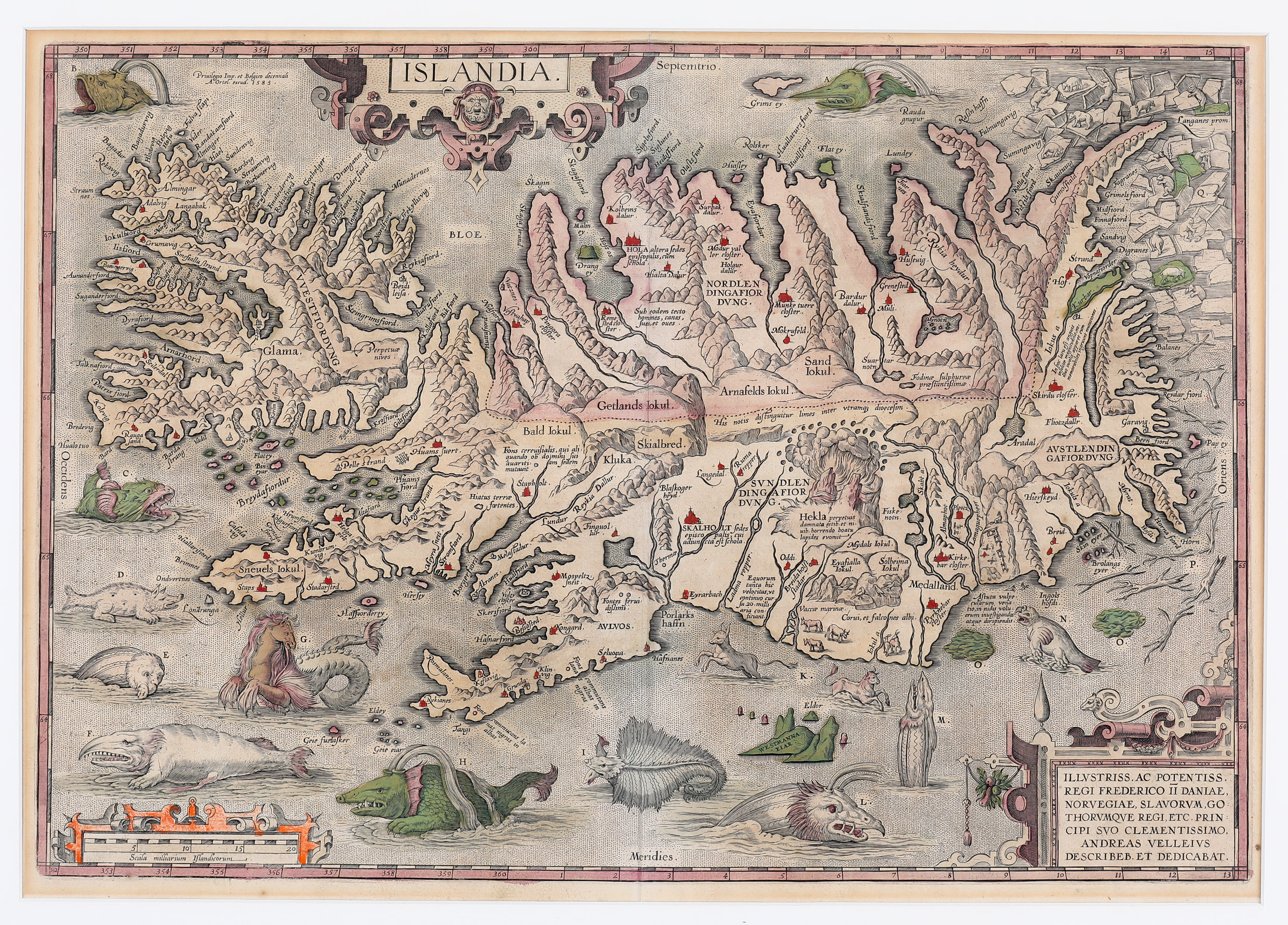
The Schulte Collection consists of 212 maps from 1507-1849 of Iceland or where Iceland is part of the map in an inset. The maps are made by Europe’s leading mapmakers and numerous maps are unique.
The collection was donated to Akureyri Municipality by the German couple Professor Dr Karl-Werner Schulte and Dr Gisela Schulte-Daxbök in 2014. At the time the collection contained 76 maps of Iceland. With additional donations by Dr Karl-Werner in memory of his wife Gisela.
The maps display the different aspect of mapmakers and how the image of Iceland changed over time and reflect the development of scientific knowledge of the country and mapmaking.