
Schulte exhibition 2026
no. 200
Tabula Moderna Prussie Livonie Norvegie et Gotie
1507
Lienhart Holle/Nicolaus Germanus/Claudius Ptolemy
Picture will be here soon.
This map of the northern regions is especially significant as the first copperplate map of Scandinavia. It is based on the earlier woodcut map from the Ulm editions of Ptolemy’s Geographia of 1482/86, but appears here in a slightly revised form.
The map comes from the rare 1507/08 Rome edition of Ptolemy’s Geographia, the final Rome edition, in which six “modern” maps were added. It was printed on two sheets, later joined, and survives in excellent condition for a work produced more than 500 years ago.
The map shows Scandinavia, Iceland, Greenland, the Baltic region, Ireland, northern Britain and northern Germany. It includes early references to the Arctic Sea as Mare Congelatum and the Arctic Circle as Circulus Articus, although the latter is placed too far south.
One of the map’s most striking features is the land bridge connecting Greenland, named Evgrovelant, with Lapland. Iceland appears in the upper left corner as an oval island surrounded by smaller islands. Unusually for such an early map, seven Icelandic place-names are included, among them Holesis, probably referring to Hólar, the episcopal see.
The map combines classical geography, medieval tradition and emerging Renaissance knowledge. Its mixture of accurate observations, inherited errors and imagined northern lands makes it an important witness to how Iceland and the North were understood in European cartography at the beginning of the 16th century.
no. 25
Islanda
1528
Benedetto Bordone (1460 – 1539)
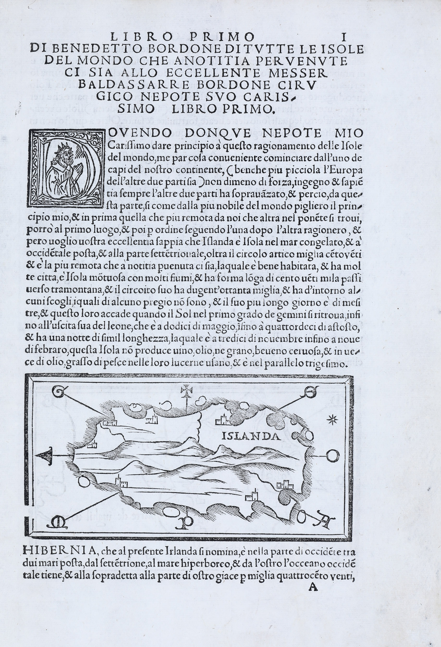
The best-known work of the Venetian cartographer Benedetto Bordone (1460–1539) is a book on the islands of the world, first published in 1528. It marks a milestone in the cartographic history of Iceland, as it contains the first printed map devoted specifically to Iceland to appear in a book.
no. 184
Tab Nova Norbegia et Gottia
1535
Lorenz Fries (c 1490 – 1531)
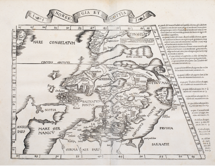
Lorenz Fries’ map is one of the earliest printed maps to focus on northern Europe, including Iceland and Greenland. First published in Strasbourg in 1522, it was based on Martin Waldseemüller’s map of 1513, itself derived from the Ptolemaic tradition. This example comes from the 1535 Lyon edition of Ptolemy’s Geographia.
The map shows Scandinavia, the Baltic region, northern Germany, Scotland, parts of England, the Faroe Islands, Orkney, Shetland, Iceland and Greenland. Iceland, named Islandia, appears in the far upper left, incorrectly placed north of the Arctic Circle. It is drawn as a long, narrow island with a few unclear place-names.
Greenland, named Engronelant, is shown close to Scandinavia and partly connected to the European landmass. Between Iceland and Greenland lies the frozen sea, Mare Congelatum. The map reflects a mixture of inherited classical geography, medieval ideas and emerging Renaissance knowledge of the North.
no. 186
Schonlandia XIII Nova Tabula
1540
Sebastian Münster (1488 – 1552)
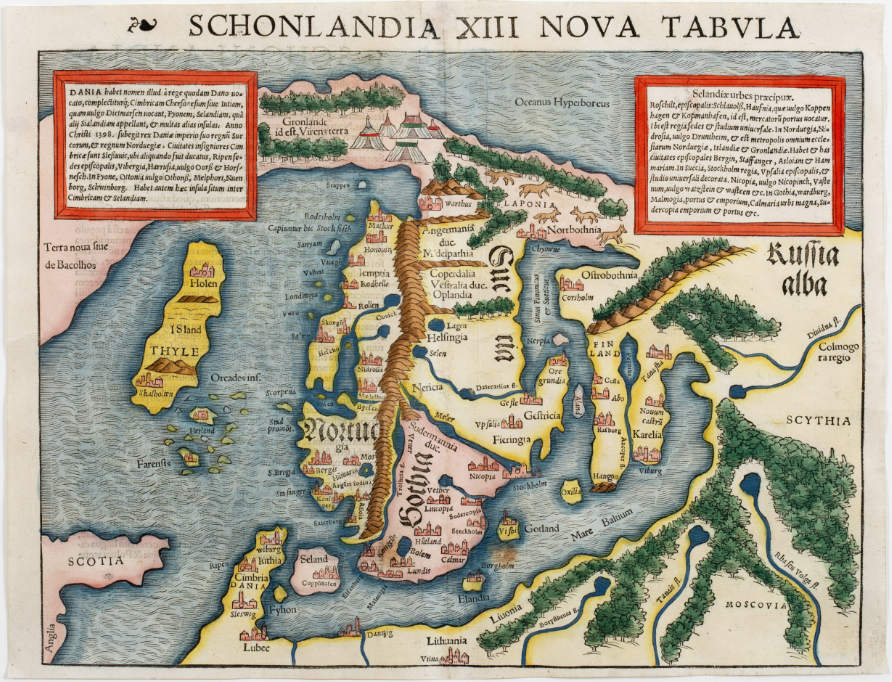
This is one of the earliest obtainable printed maps of Scandinavia, published only in Sebastian Münster’s Geographia of 1540 and 1542. It is therefore extremely rare. In 1545 it was replaced by a new map based on Olaus Magnus’ Carta Marina.
The map is based on Jacob Ziegler’s 1532 map, but extends farther north to include the Arctic Ocean. It mainly shows Scandinavia, with parts of Russia, the Baltic region, northern Germany, eastern England and Scotland, as well as Orkney, Shetland and the Faroe Islands. The map also includes illustrations of northern peoples, animals, tents and natural features.
Of particular interest are Greenland and Iceland. Greenland is connected by a land bridge to Lapland, while Iceland appears in a north–south orientation and is named both Thyle and ISland. Only four Icelandic place-names are shown. The bishoprics of Skálholt and Hólar are marked with church symbols, but Hekla is absent.
no. 187
Septentrionales Regiones
1542
Sebastian Münster (1488 – 1552)
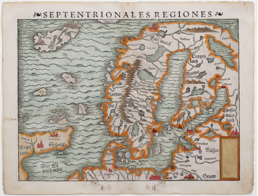
This rare map is the second state of Sebastian Münster’s 1540 map, first published in 1545 in a Latin edition of Cosmographia universalis. Unlike the earlier version, it is no longer based on Jacob Ziegler’s map of 1532, but on Olaus Magnus’ Carta Marina of 1539.
The map shows Scandinavia, the Baltic region, northern Germany, part of Russia, eastern England, Scotland and several northern island groups, including the Hebrides, Orkney, Shetland, the Faroes and Thule. Iceland, named Ißland, appears in the upper left corner.
The depiction of Iceland is sparse. The bishoprics of Skálholt and Hólar are not shown, and the only Icelandic feature identified is the famous volcano Hekla, marked as Heckl’berg.
no. 70
Septentrionales Regiones
1548
Giacomo Gastaldi (1500-1566)
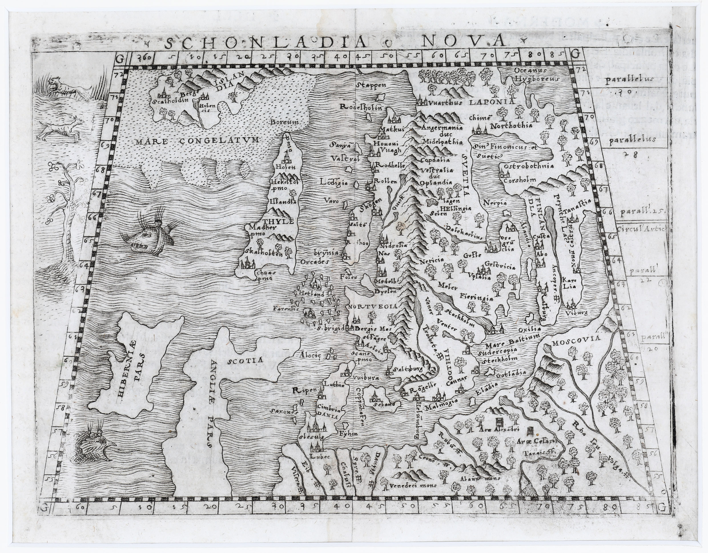
Giacomo Gastaldi is considered the foremost Italian cartographer of the sixteenth century. He was one of the leading scholars of the Venetian Republic and an important source of information for other cartographers.
Gastaldi published the first pocket-sized collection of maps and the first atlas to include maps of America, which was then "newly discovered." He revolutionized mapmaking by using copper plates instead of wood, which made the maps more delicate and allowed for more details to be included.
Notice that there is a land bridge between Greenland and Scandinavia, just like the one on the Zeno map.
no. 155
Untitiled
1554
Johannes Magnus (1488 – 1544) & Olaus Magnus (1490 – 1557)
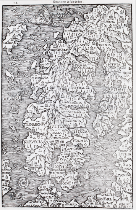
This very rare map first appeared in Johannes Magnus’ Historia de omnibus Gothorum Sueonumque regibus, published posthumously in 1554 by his brother Olaus Magnus. The work, richly illustrated with woodcuts, was the source of the map.
Only a few printed maps of Scandinavia predate it, including those by Waldseemüller, Fries, Ziegler and Gastaldi. In 1555, Olaus Magnus republished the work under the title Historia de gentibus septentrionalibus and issued a revised version of the map. Later editions introduced further changes.
The map shows Scandinavia, the Baltic region and neighbouring lands, including parts of England and Scotland. It is decorated with a compass rose, sea monsters, rowing boats and sailing vessels. Iceland is placed too close to Norway and shown with an incorrect orientation.
The information on Iceland is limited. The island is named Isladia, a spelling later corrected in Olaus Magnus’ editions. Only a few buildings, probably representing the bishoprics of Skálholt and Hólar and other settlements, are shown, together with four volcanoes.
no. 150
Carta Da Navegar De Nicolo et Antonio Zeni Furono In Tramontana Lano MCCCLXXX
1558
Nicolo Zeno (1326 – 1402) and Antonio Zeno (1330-1405)
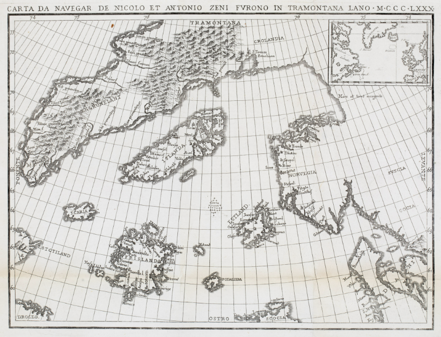
Nicolo Zeno and his brother Antonio were explorers from Venice, belonging to a prominent family that held exclusive rights to sea transportation to the Holy Land during the Crusades. Nicolo Zeno the Younger (1515-1565), a chronicler of Venice, wrote a book about the brothers' exploratory journeys to northern regions, reaching America before Columbus.
Their journey was quite extraordinary. The expedition led them to the shores of Frislandia, reportedly off the coast of the British Isles, where Prince Zichmni rescued them. For 14 years, the brothers wandered with the prince, engaging in battles with his enemies, which took them through various islands in the North Atlantic, all the way to Iceland, Greenland, and Newfoundland.
The book about the adventures of the Zeno brothers included a map that influenced cartography of Iceland for decades. Doubts about the reliability of the narrative grew over time, with many considering it pure fiction. However, it wasn't until 1898 that a book by Frederick W. Lucas was published in Britain, arguing that the story and map were outright forgeries.
The depiction of Iceland is most likely based on Olaus Magnus's 1539 map. The map also features mysterious islands, including Frisland, which appear on later maps.
no.188
Gotland oder Gothen
1560
Sebastian Münster (1488 – 1552)
Picture will be here soon
This woodcut page comes from the 1560 German edition of Sebastian Münster’s Cosmographia, published by Heinrich Petri in Basel. The map appears in the upper part of the page, accompanied below by decorative elements and a German description of the regions shown.
The map shows Scandinavia, the Baltic region, eastern Scotland, Shetland, the Faroe Islands and part of Iceland. Compared with other versions, the image area is smaller and less detailed, with only major cities marked. The landscape is characterized by rope-like mountains and broad rivers.
Iceland, named Ißland, is only partly shown, with its western section omitted. No Icelandic place-names or symbols are included. The reverse side contains a German description of the northern lands, illustrated with figures of a fisherman and a woman in festive dress.
no. 75
Septentrionalium Partium Nova Tabula
1561
Ruscelli 1561
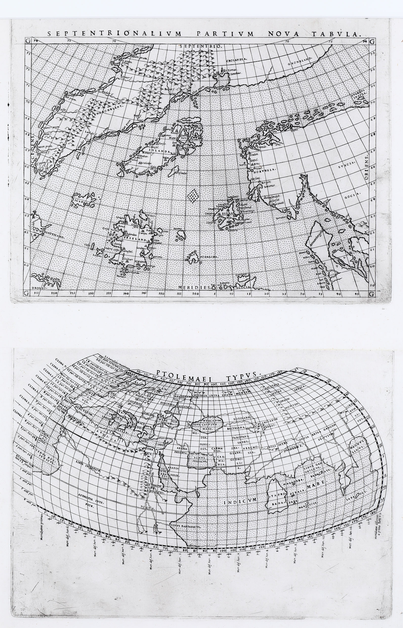
The map above is by Girolamo Ruscelli (1504-1566). What makes this map unique is that it consists of two different maps engraved on the same plate. Typically, the maps are cut apart after printing and bound separately in the atlas.
Ruscelli's map is based on Zeno's map with some modifications. Can you spot the differences?
no. 178
Schonladia Nuova
1562
Girolamo Ruscelli (1504 – 1566)
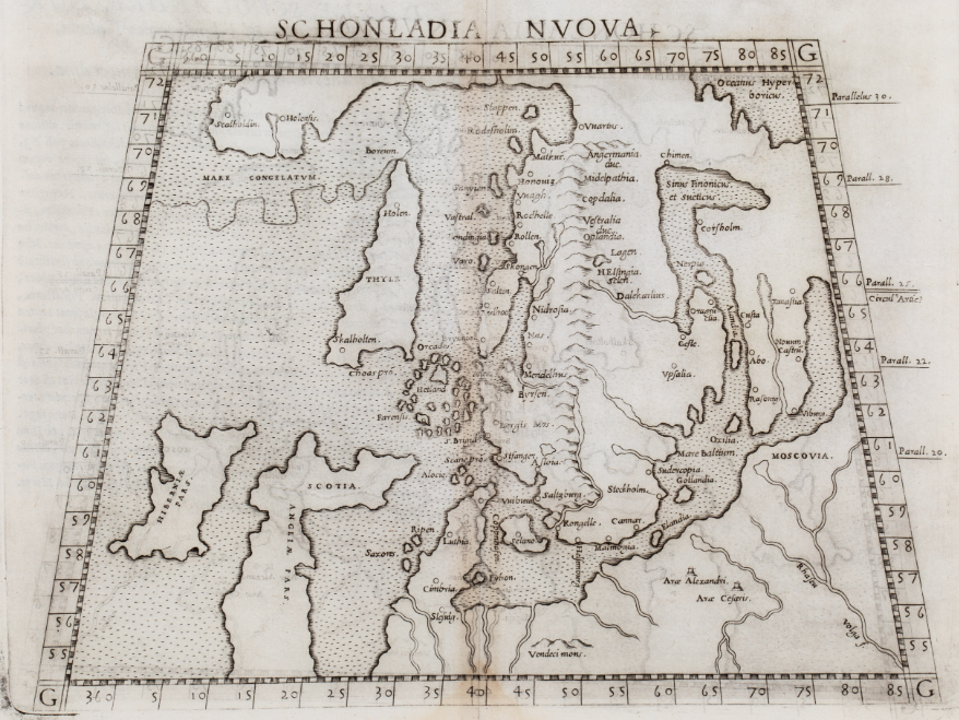
This scarce first state of Ruscelli’s map is one of the earliest obtainable printed maps of Scandinavia. It was based on Gastaldi’s much rarer miniature map of 1548 and published in Ptolemy’s Geography.
The map shows Scandinavia, the Baltic region, western Russia, Poland, northern Germany, Ireland, Scotland, northern England, Iceland and Greenland. The frozen northern sea is marked as Mare Congelatum. Norway and Greenland are separated by a narrow strait but appear almost connected by a land bridge.
Iceland is shown in a highly distorted form and named Thyle, referring to the legendary island of Thule. Only two Icelandic place-names are included: Skalholten and Holen, representing the bishoprics of Skálholt and Hólar. Ruscelli corrected some errors from Gastaldi’s map, but the name Islandia is missing entirely.
no. 72 & 68
Untitiled
1565 / 1567
Olaus Magnus
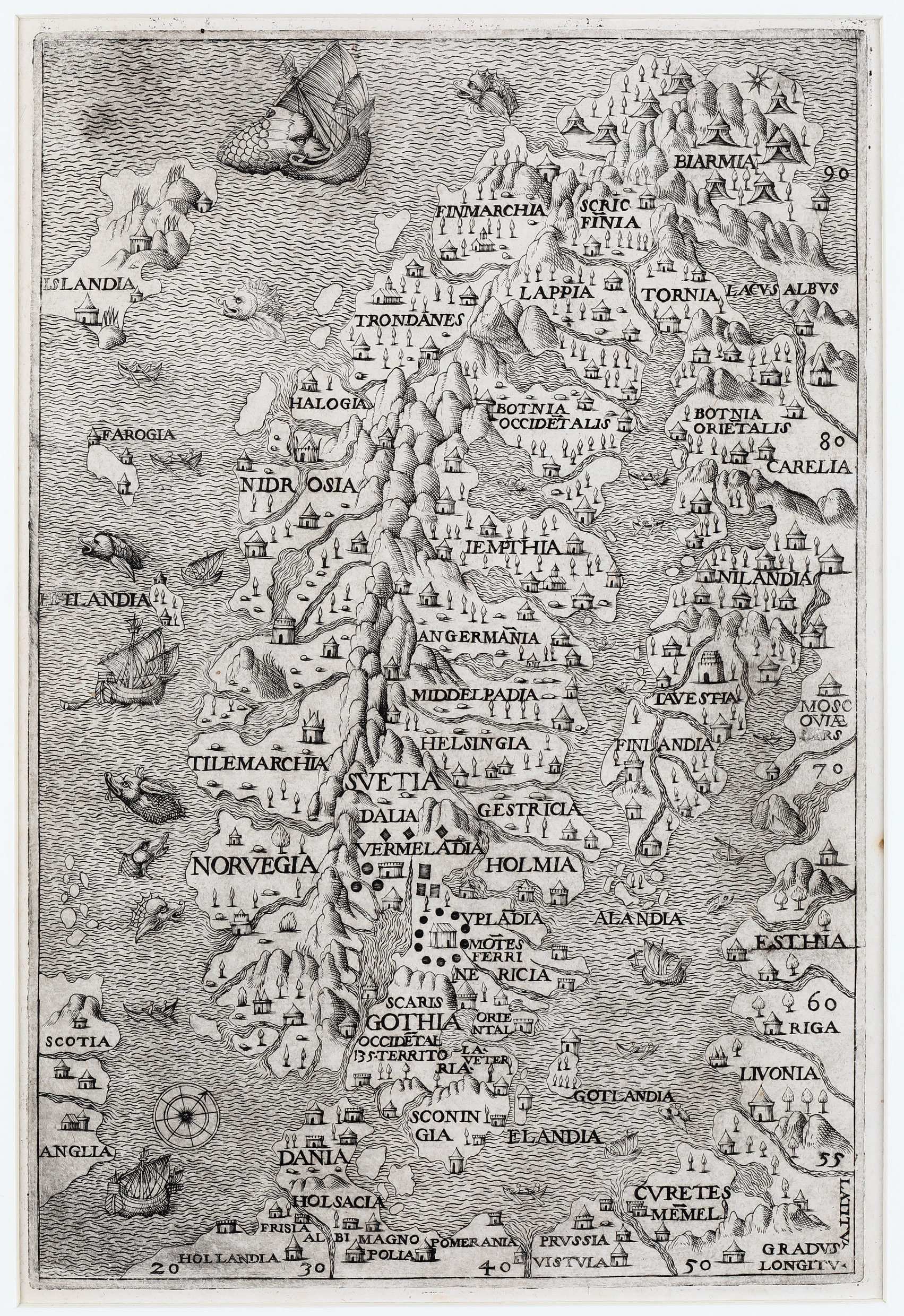
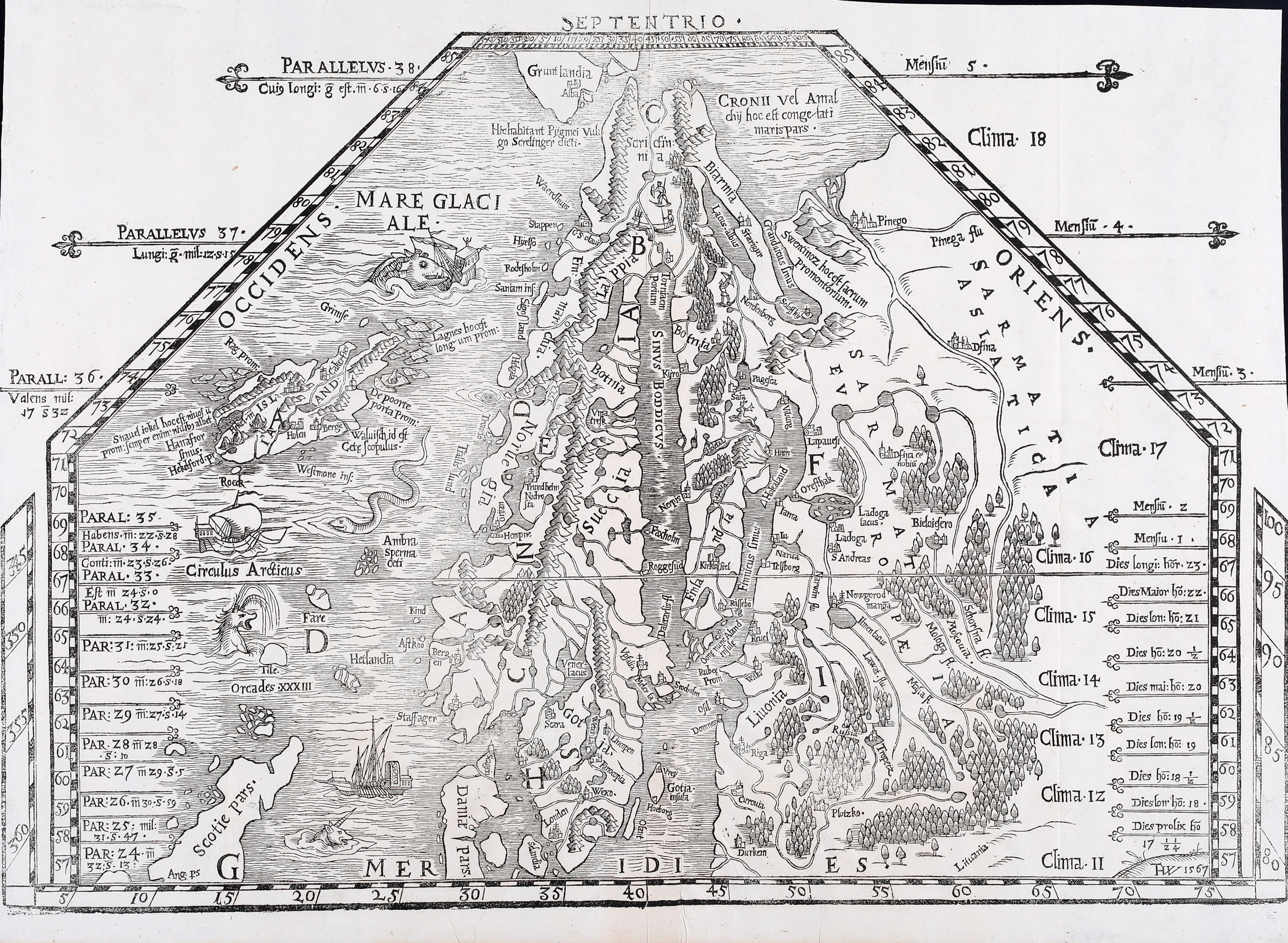
Olaus Magnus (1490-1557) was a Swedish geographer, cartographer, and Catholic priest. One of his priestly duties was selling indulgences, which took him around the Nordic countries, though not to Iceland. During the Reformation, Magnus fled to Rome with his brother, who was an archbishop. There, they utilized their local knowledge to create a geography book and maps of the Nordic regions, published in Venice in 1539. Their most famous map, Carta Marina, is unusually large, measuring 170 x 125 cm and consisting of 9 parts.
In 1555, Olaus Magnus, then Archbishop of Uppsala residing in Rome, published his work "Description of the Northern Peoples," intended as a commentary book for the "Carta Marina." It describes the nature and life of people in the Nordic countries, dark winters, violent currents, and sea monsters. The book garnered significant interest throughout Europe and became a foundational work for later cartographers. It was translated into German (1567), English (1658), and Dutch (1665), but not into Swedish until 1909.
Olaus Magnus never returned to Sweden and is buried in St. Peter's Basilica in Rome.
no. 57
De Islandia Insula
1566
Ferando Berteli (1559 – 1584)
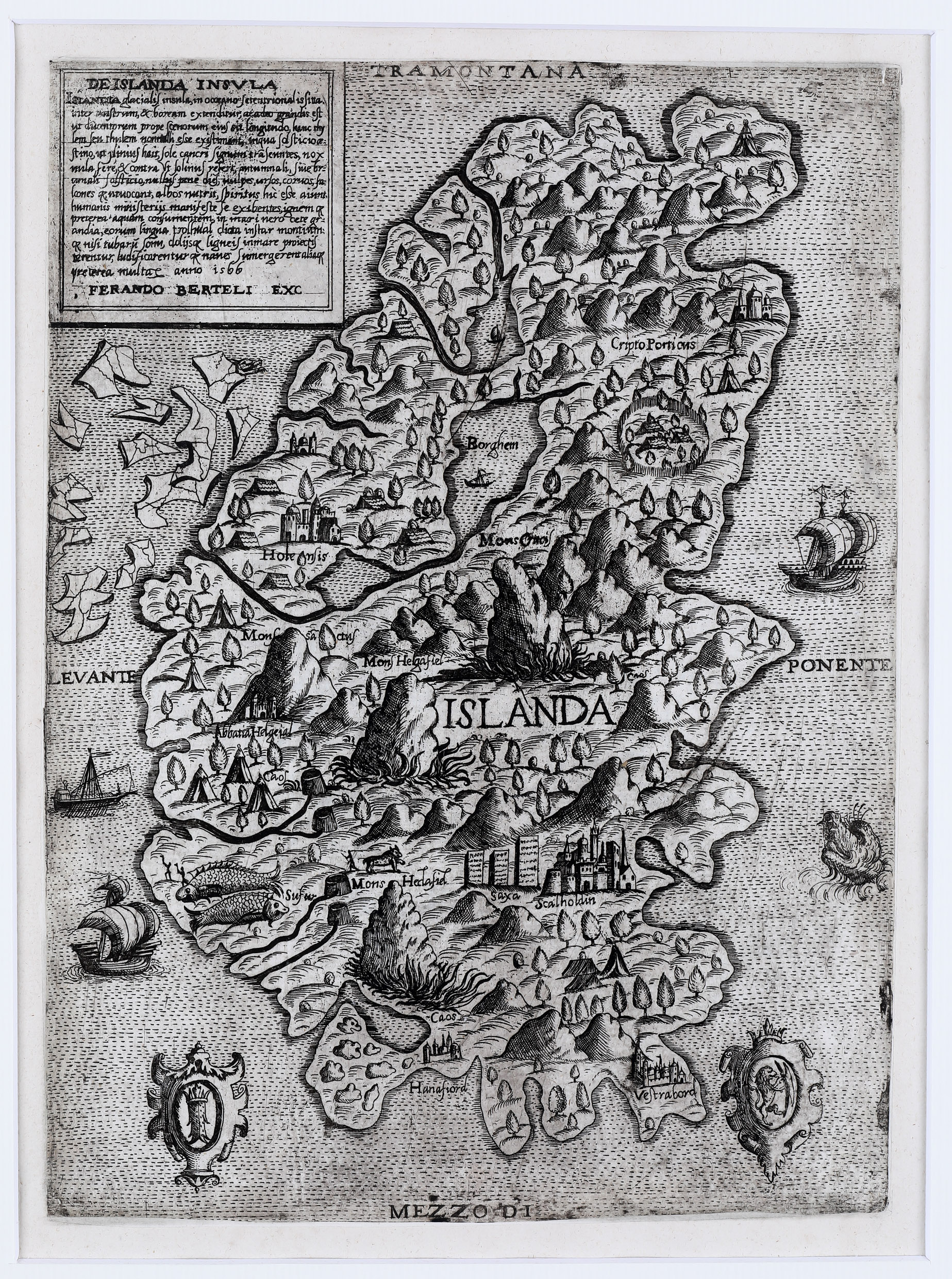
This rare map of Iceland was published by the Venetian mapmaker Ferando Berteli in 1566. Although based on Olaus Magnus’ Carta Marina of 1539, the map contains a striking error: east and west have been reversed.
Iceland, named Islanda, fills the centre of the map. Around it are sailing vessels, icebergs and a large sea monster. Within the island, several settlements and churches are marked, including the bishoprics of Skálholt and Hólar. Skálholt is shown with a large church resembling an Italian cathedral, while Hólar is marked by a smaller church.
The map also highlights Iceland’s dramatic natural features. Four mountains are named, including Heclafiel, the volcano Hekla, shown with fire. Sulphur springs and other place-names add to the image of Iceland as a remote land shaped by fire, ice and wonder.
The collector acquired the map at a Sotheby’s auction in London in 1992. Due to a misunderstanding, the invoice was mistakenly addressed to Johannesburg in South Africa instead of Johannisberg in Germany. Fortunately, the error was discovered before the map was sent to the wrong continent. This shows how map reading is important!
no. 56
Septentrionalium Regionum descrip.
1570
Abraham Ortelius (1527 – 1598)
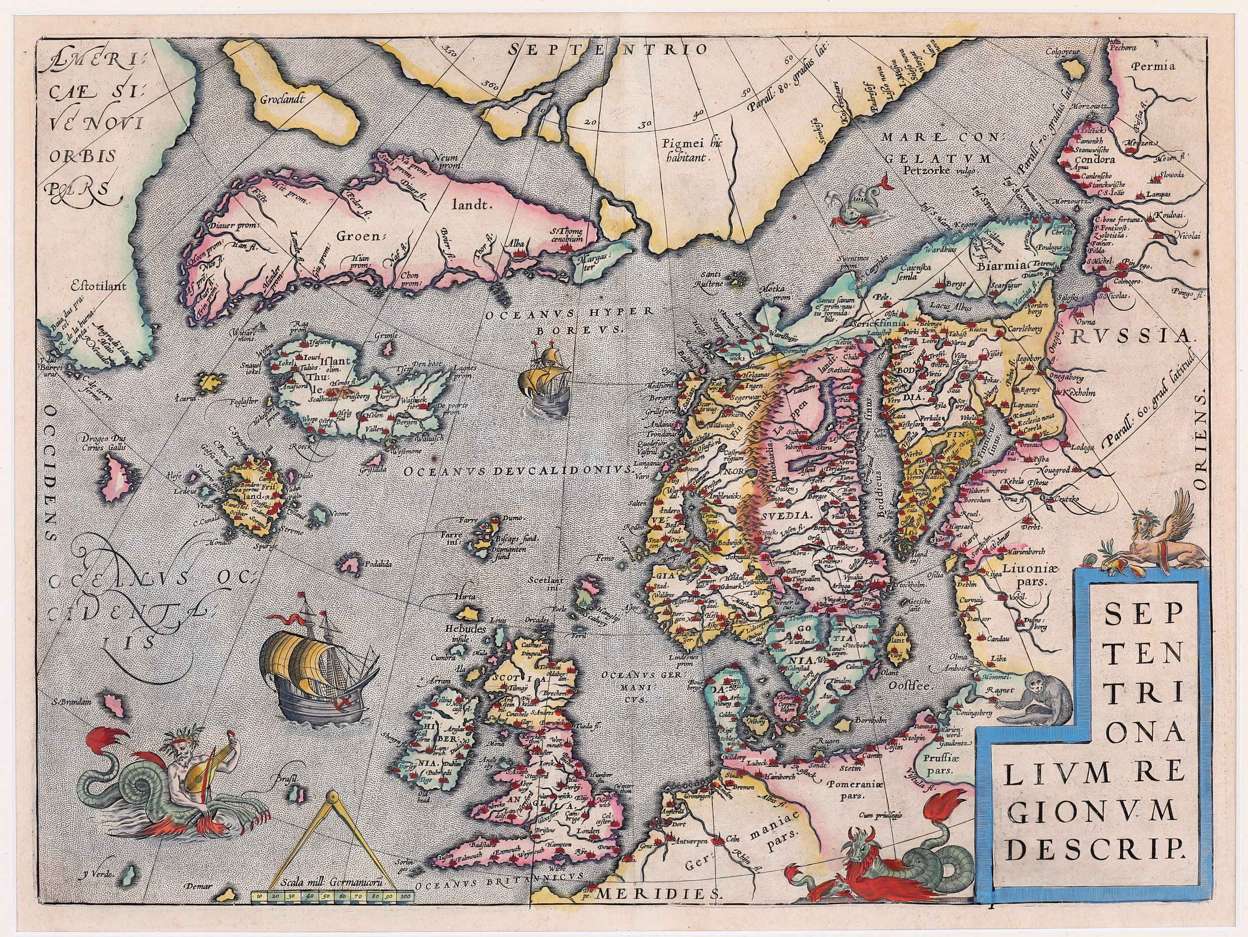
This impressive map by Abraham Ortelius appeared in Theatrum Orbis Terrarum and was probably the most important map of the North Atlantic in its time. It brought together the geographical knowledge of several 16th-century cartographers, including Jakob Ziegler, Olaus Magnus, Gerardus Mercator and Nicolo Zeno.
The map covers Scandinavia, the Arctic regions, Greenland, Iceland and parts of North America, here named Estotiland. It also includes several mythical islands, such as Frisland, Icaria, Drogeo, S. Brandam and Brasil, reflecting both geographical knowledge and inherited legends.
Iceland is based largely on Olaus Magnus’ Carta Marina of 1539 and is named both Islant and Thule. Twenty-five Icelandic place-names are included, among them Skálholt and Hólar, although the bishoprics are incorrectly located. Snæfellsjökull also appears on the map.
Richly decorated with sea monsters, ships and mythical creatures, the map became the standard representation of the North Atlantic for about forty years and was printed from the same copperplate until 1641.
Notice which glacier is included on the map.
no. 2
Islanda – Descrittione Dell‘Isola D‘Islanda
1572
Tomaso Porcacchi (1530 – 1585) & Girolamo Porro (c. 1520 – c. 1604)
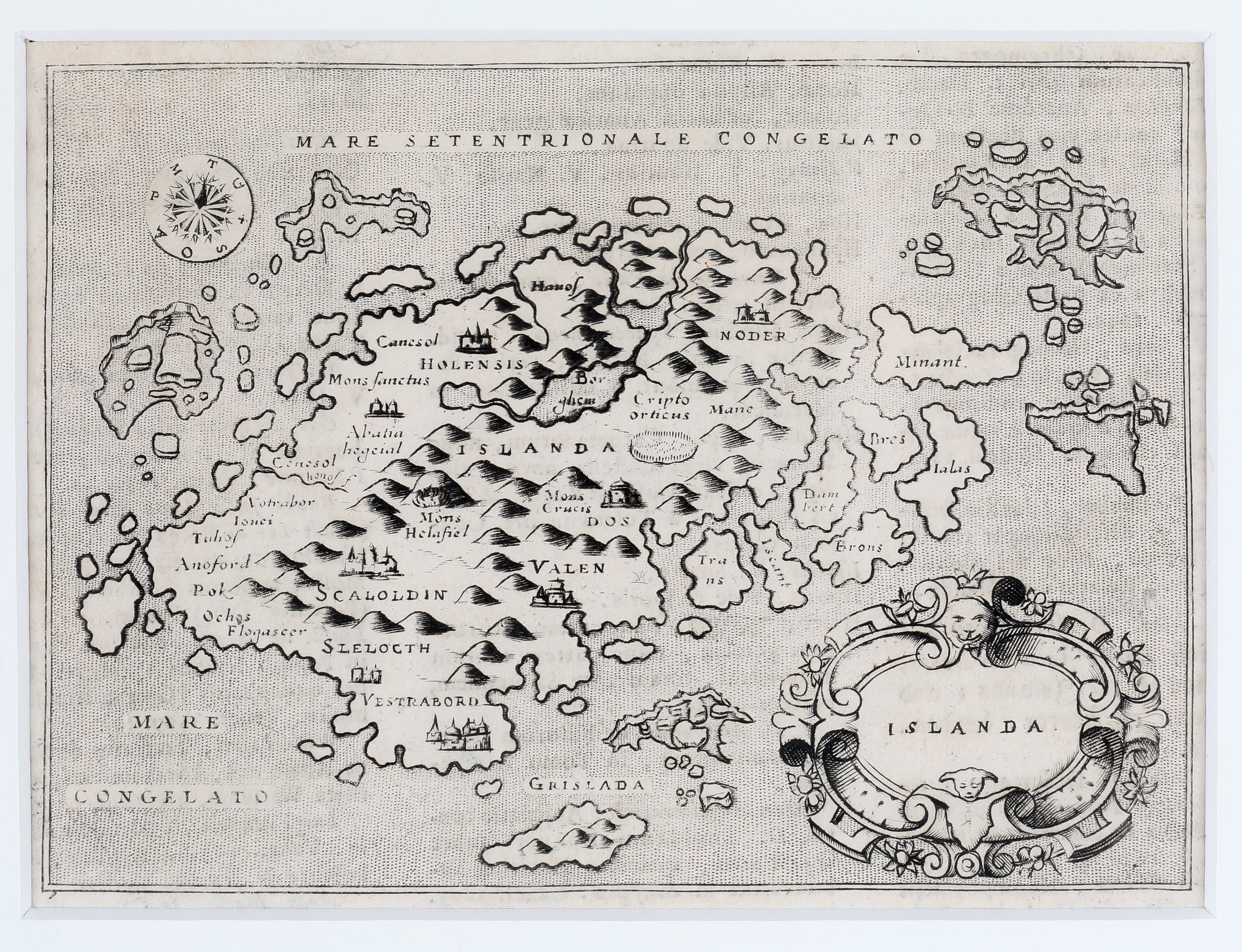
This map is based on Olaus Magnus’ famous Carta Marina, but includes several changes. The drift ice off Iceland’s east coast has been transformed into seven islands, as on the Zeno map, while a large island south of Iceland, named Grislada, may refer to the Westman Islands.
Hólar and Skálholt are placed more accurately, but both are shown as Italian-style cathedrals rather than Icelandic turf churches. Hekla is named Mons Helafiel, alongside another mountain, Mons Crucis. Rivers, lakes and village-like buildings decorate the island, though they reflect imagination more than Icelandic reality.
"This map was the second in our just beginning collection and has always played a special role as it arrived on the 24th of July 1976, our wedding day. A week later we started our honeymoon trip to Iceland. Our vehicle was a Land Rover and our accomodation was a tent. We ended up in Akureyri and enjoyed Hotel Kea." Karl-Werner Schulte
no. 28
Islanda (Descrittione Dell‘ Isola D‘Islandia)
1572
Tomaso Porcacchi (1530 – 1585) & Girolamo Porro (c. 1520 – c. 1604)
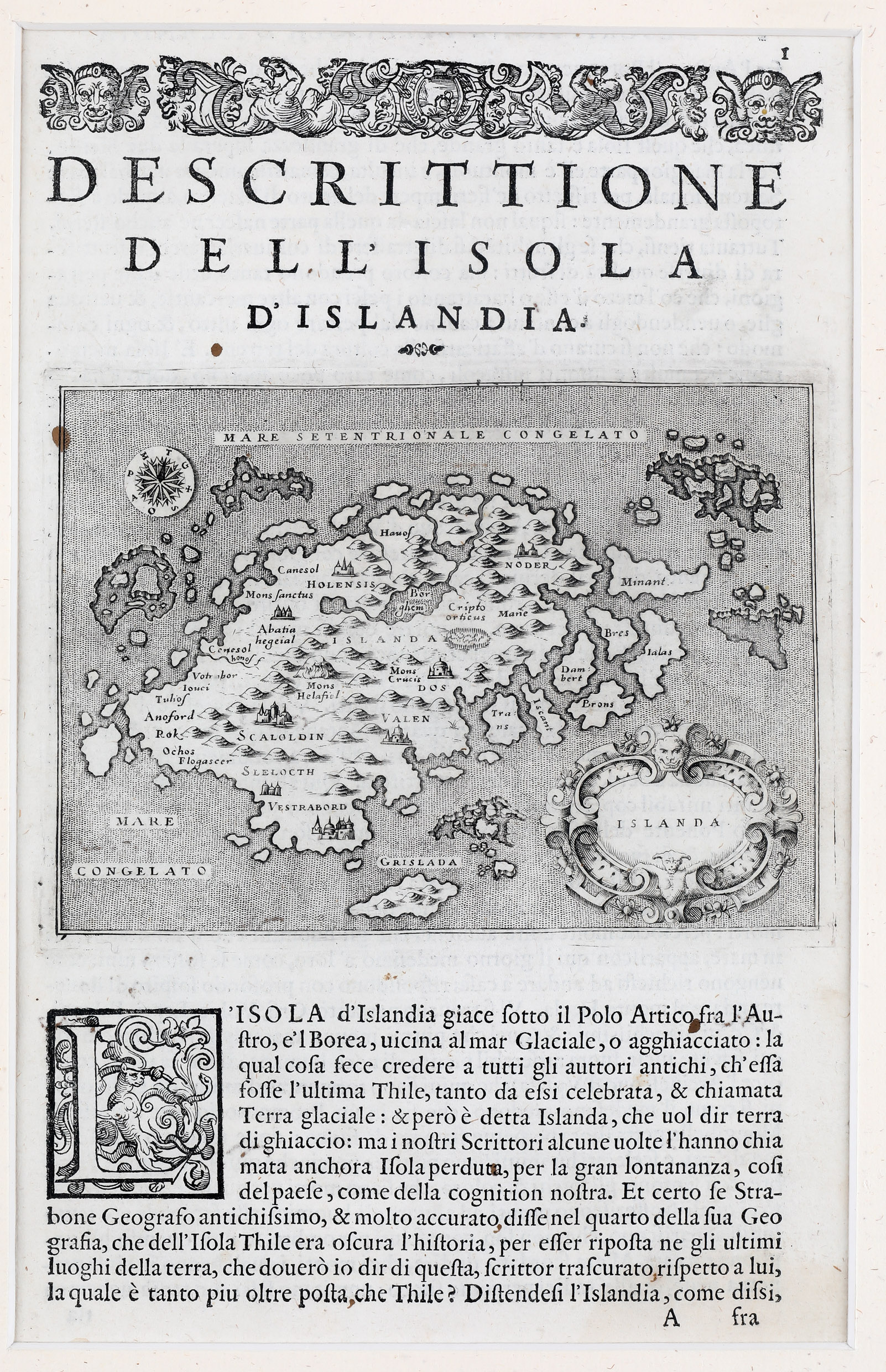
Tomaso Poracchi (1530-1576) was a geographer and historian from Venice, like Girolamo Porro (c.1529-c.1604), who was a master engraver in both copper and wood. The map was published in their book "Islands of the World," which included diverse information about the islands and their inhabitants.
no. 157
Septenirionalium Partium Nova Tabula
1574
Girolamo Ruscelli (1504 – 1566)
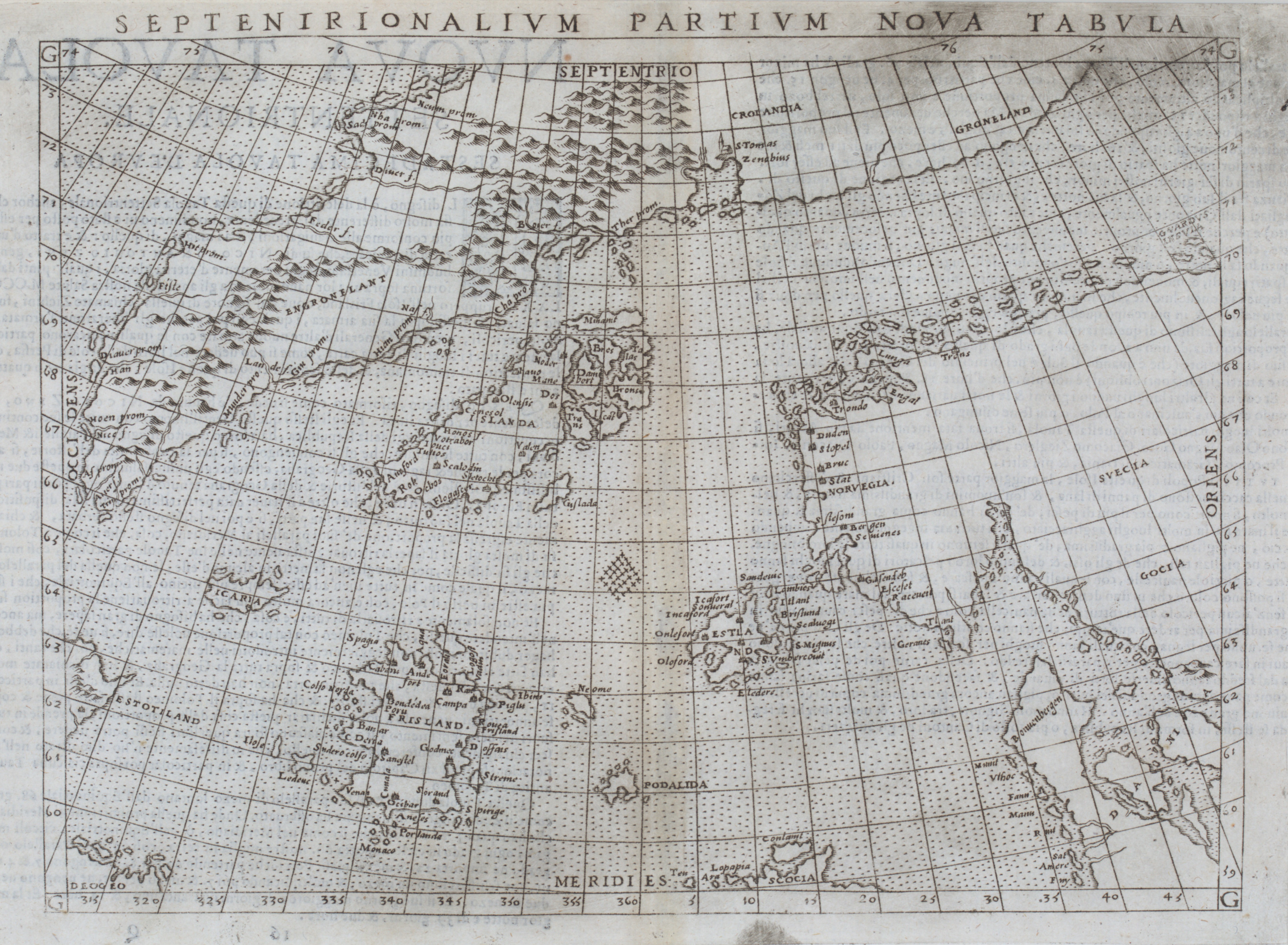
This rare map by Girolamo Ruscelli, published in 1574, is based on the famous Zeno map of the North Atlantic. The Zeno map claimed to show the voyages of the Venetian brothers Nicolo and Antonio Zeno in the 1390s, but is now widely regarded as unreliable, and possibly a deliberate fabrication.
The map covers the North Atlantic from Scandinavia and Greenland to Iceland, Estotiland and Deogeo, names associated with North America. Iceland is shown in a distorted form, based partly on Olaus Magnus’ Carta Marina. Five church symbols are included, but only Skálholt and Hólar can be identified.
Most striking are the many mysterious islands scattered across the ocean, including Frisland, Icaria, Grislada and Podalida. Some may refer loosely to real places, while others appear to be imaginary. These “Zeno islands” remained on maps for centuries, showing how legend, ambition and uncertainty shaped early cartography.
no. 27
De Islandia Insula
1575
Giovanni Francesco Camocio (1501 – 1575)
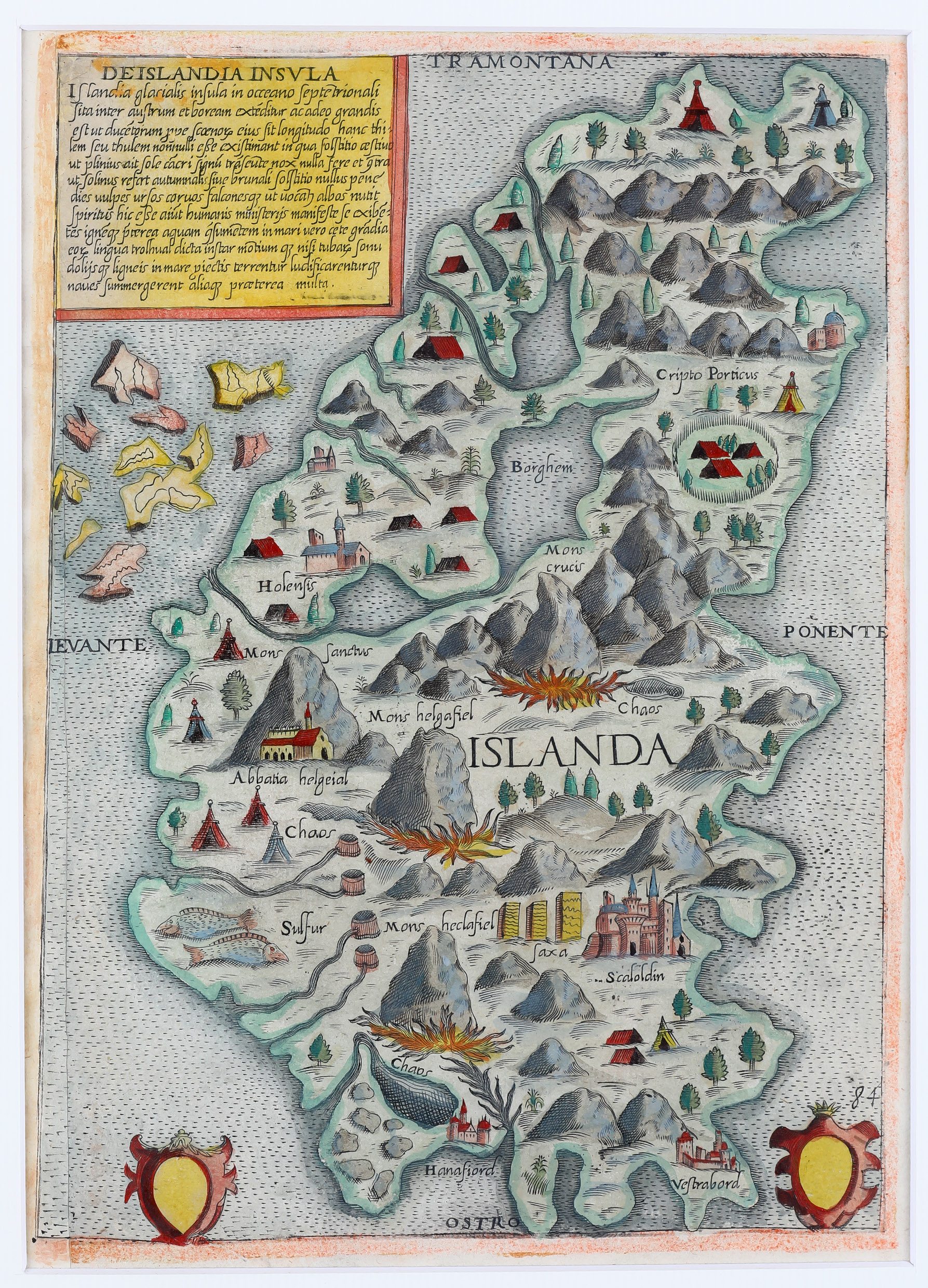
Giovanni Francesco Camocio (1501-1575) was both a publisher and master engraver from Venice. Typically, he published his maps individually, however customers could order specific maps to be bound together into an atlas. This extremely rare map is likely from a volume of island maps published without a title between 1566 and 1574.
no. 29
Thyle
1576
Sebastian Henricpetri (1508 – 1579)
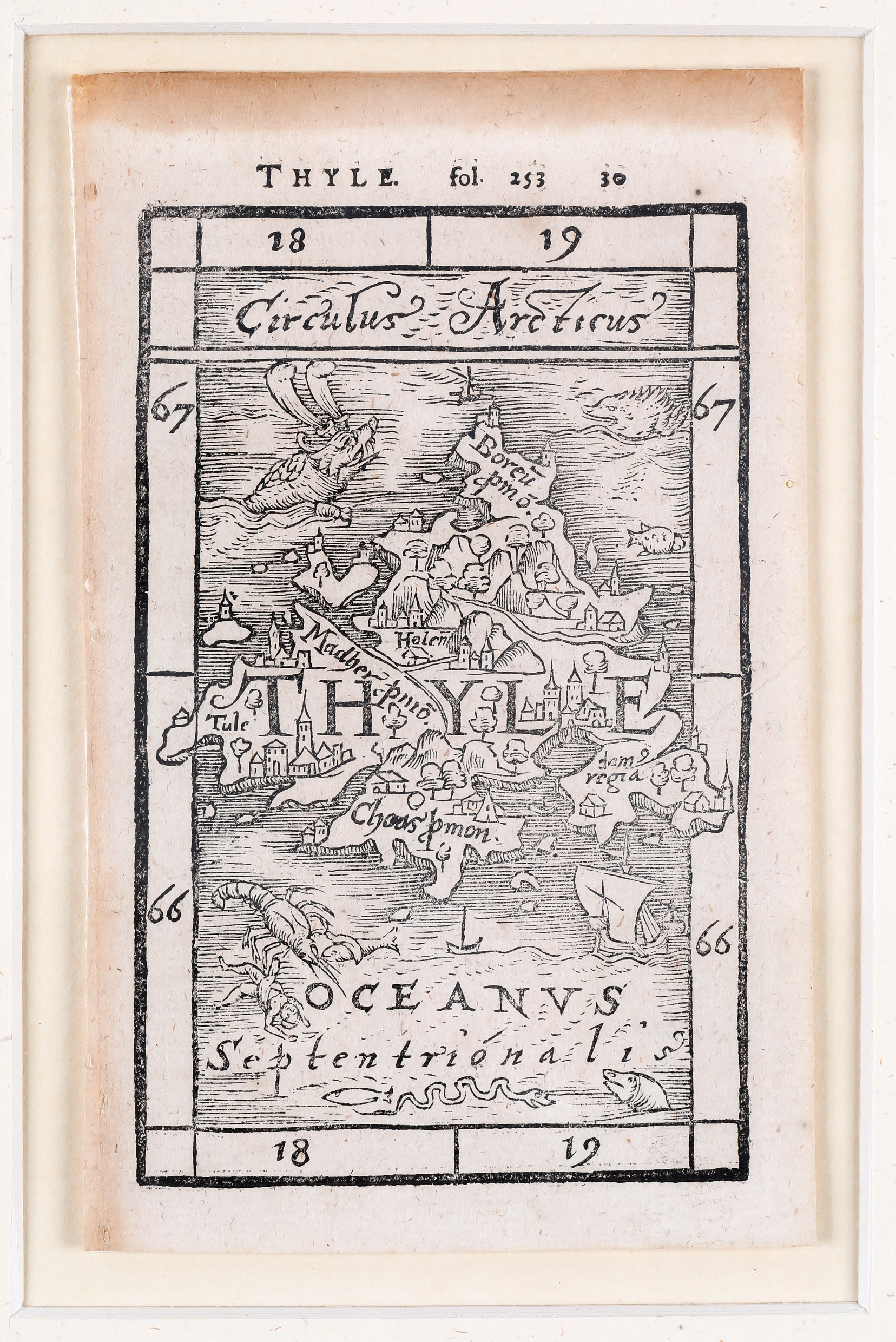
Sebastian Henricpetri was a Swiss publisher who notably released works by the Roman geographer Pomponius Mela (unknown - 45 AD). One such work, Description of the World, published in the year 43, was an important reference for geographical knowledge until the Age of Discovery.
At the time this map was created, Iceland was unknown. The name Thule likely originated from the works of the geographer Pytheas (359-289 BC) from Marseille.
no. 175
Gemeine beschreibung Aller Mitnächtigen Länder
1578
Sebastian Münster (1488 – 1552)
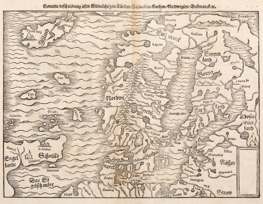
This woodcut map comes from the 1578 German edition of Sebastian Münster’s Cosmographia, published by Heinrich Petri in Basel. It is an example of Münster’s second map of Scandinavia, first issued in 1545 and used in later editions until 1579.
The map shows Scandinavia, parts of Russia, the Baltic region, northern Germany, northeast England, Scotland and the northern islands, including the Hebrides, Orkney, Shetland and the Faroe Islands. It also includes Tyle, referring to the legendary island of Thule.
Iceland appears on the map, but with very limited detail. The only Icelandic name shown is Heckl’berg, the volcano Hekla.
no. 176
Gotland oder Gothen
1578
Sebastian Münster (1488 – 1552)
This woodcut page comes from the 1578 German edition of Sebastian Münster’s Cosmographia, published by Heinrich Petri in Basel. The page includes text on the northern lands and a genealogy of the Danish kings, with the map placed in the lower part.
The map shows Norway, Sweden, Finland, the Baltic region, eastern Scotland and part of Iceland. It is smaller and less detailed than Münster’s larger map of Scandinavia, but has similar rope-like mountains and broad rivers.
Iceland, named Ißland, is only partly shown and appears without any place-names or symbols.
no. 77
Islandia
1592
Matthias Quad (1567 – 1613)
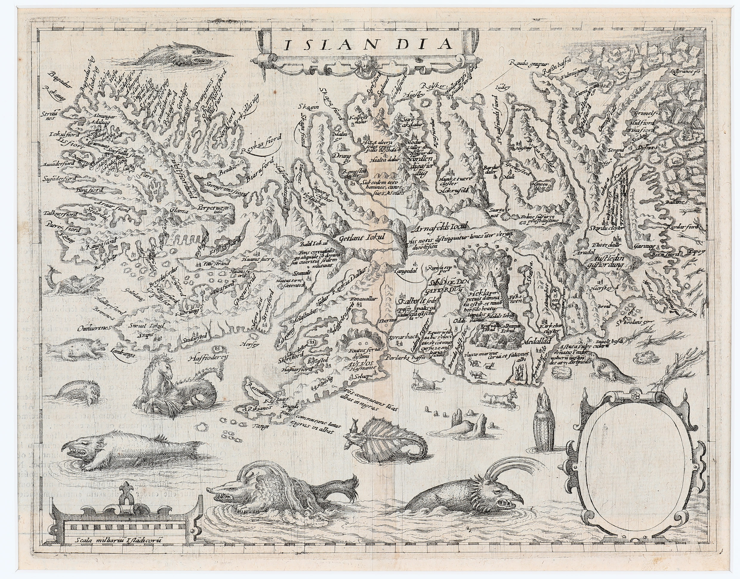
Matthias Quad von Kinckelbach (1567-1613) was a German engraver and author of historical and geographical works. In two of these works, there is a map of Iceland, which is a reduced version of Ortelius's map from 1585.
Typically, in the cartouche there is an image or dedication to the person who commissioned or sponsored the work. On a similar map, No. 62, which is in the map collection, there is an image of Christian IV, King of Denmark. Why, then, is the decorative cartouche empty on this map? Was this piece used to sell the work to the king, with the intention of adding his image later, or that of another purchaser? Or has the king's image been removed from the map?
In either case, the absence of the king makes this map extremely rare.
no. 183
Scandia Sive Regiones Septentrionales
1597
Giovanni Antonio Magini (1555 – 1617)
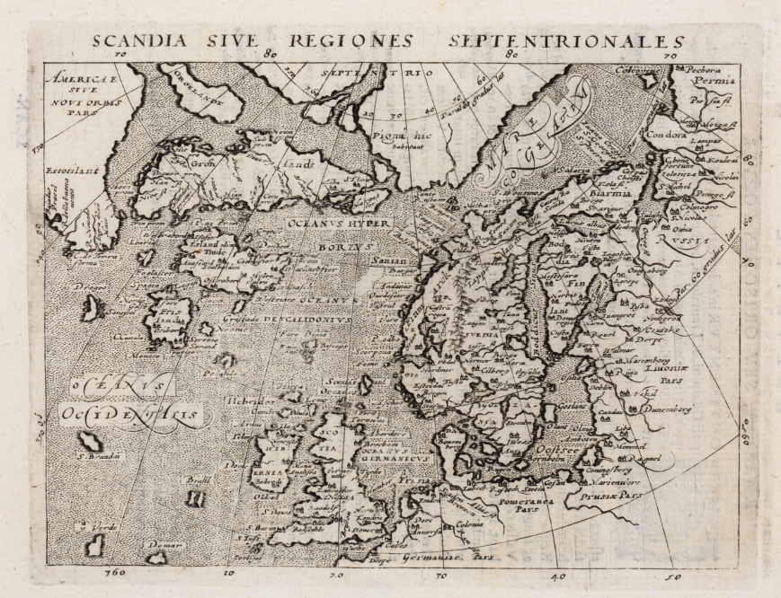
This rare copperplate map of the Arctic comes from the 1597 Cologne edition of Ptolemy’s Geography, published by Petrus Keschedt with newly engraved plates. It is based on Giovanni Antonio Magini’s map, which in turn drew on Abraham Ortelius’ influential map of the North Atlantic.
The map covers the region from Russia in the east to Estotilant in the west, a name associated with North America through the Zeno map tradition. Greenland is shown as two separate islands, and Iceland is named Island olim Thule — “Iceland, once Thule”.
Only a few Icelandic place-names are included, among them Skálholt and Hólar, both marked with church symbols. Hekla is not shown.
The map is especially notable for its many mythical islands, including Frisland, Brasil, S. Brandain, Drogeo and Icaria. Such islands appeared on maps of the North Atlantic for more than a century, reflecting the powerful mixture of geography, legend and inherited error in early modern cartography.
no. 11
Islandia (Islandia Insula)
1598
Abraham Ortelius (1527 – 1598) & Philip Galle (1537 – 1612)
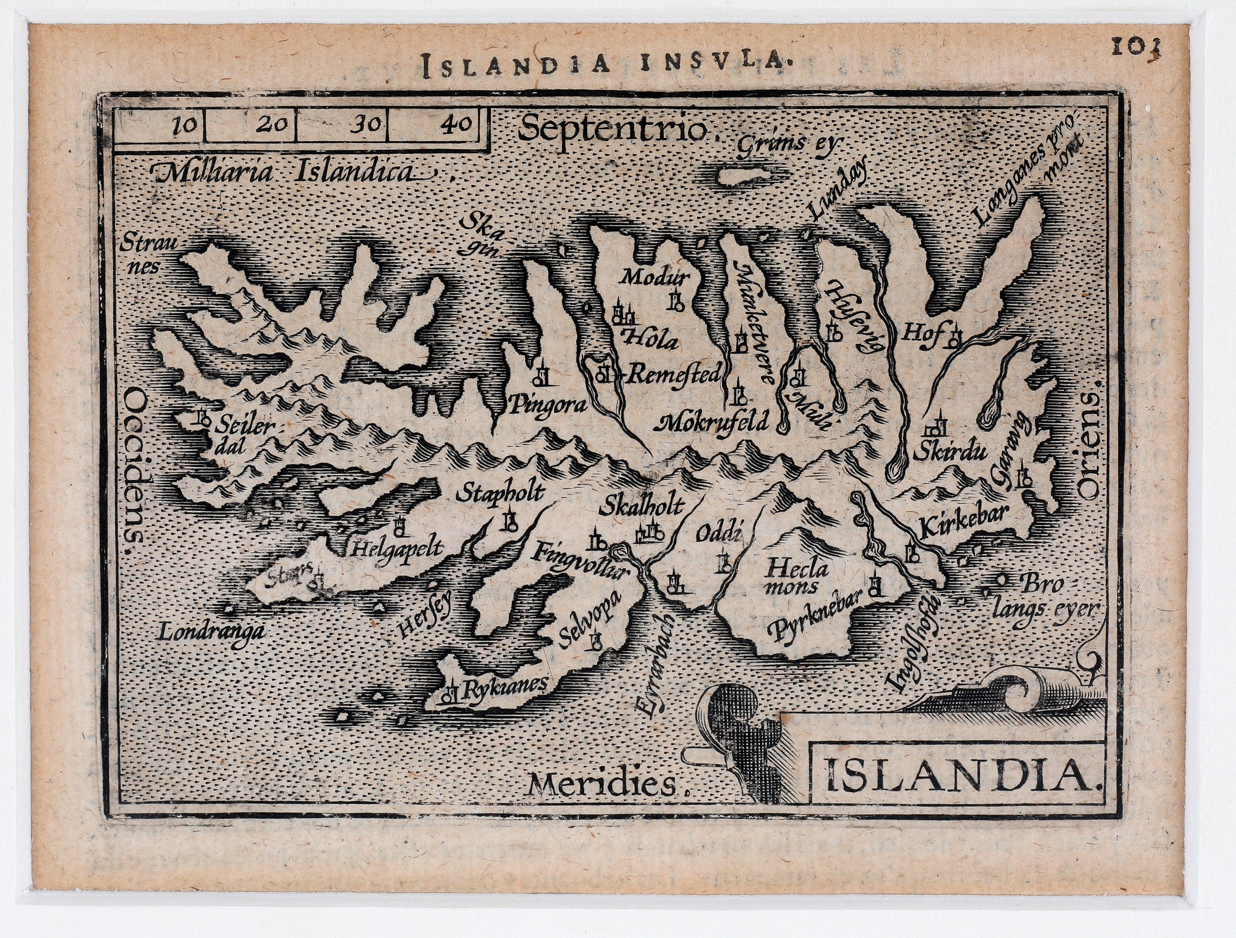
This miniature map of Iceland comes from the Epitome, a reduced version of Ortelius’ atlas. Because of its small size, many place-names and all the sea creatures found on the larger Ortelius map have been omitted.
The map is titled Islandia Insula. Several churches are shown, including the bishoprics of Skálholt and Hólar. Hekla is named as Hecla mons, but appears as only one of many mountains on the island.
Compared with the later Ortelius/Vrients map of 1601, this version is smaller and simpler, with a plain border, no longitude or latitude markings, and a distance scale in Icelandic miles.
no. 13
Descriptio Islandiae (Islandia)
1598
Pieter van den Keere (1571 – 1646), Barent Langenes & Cornelis Claesz (1551 – 1609)
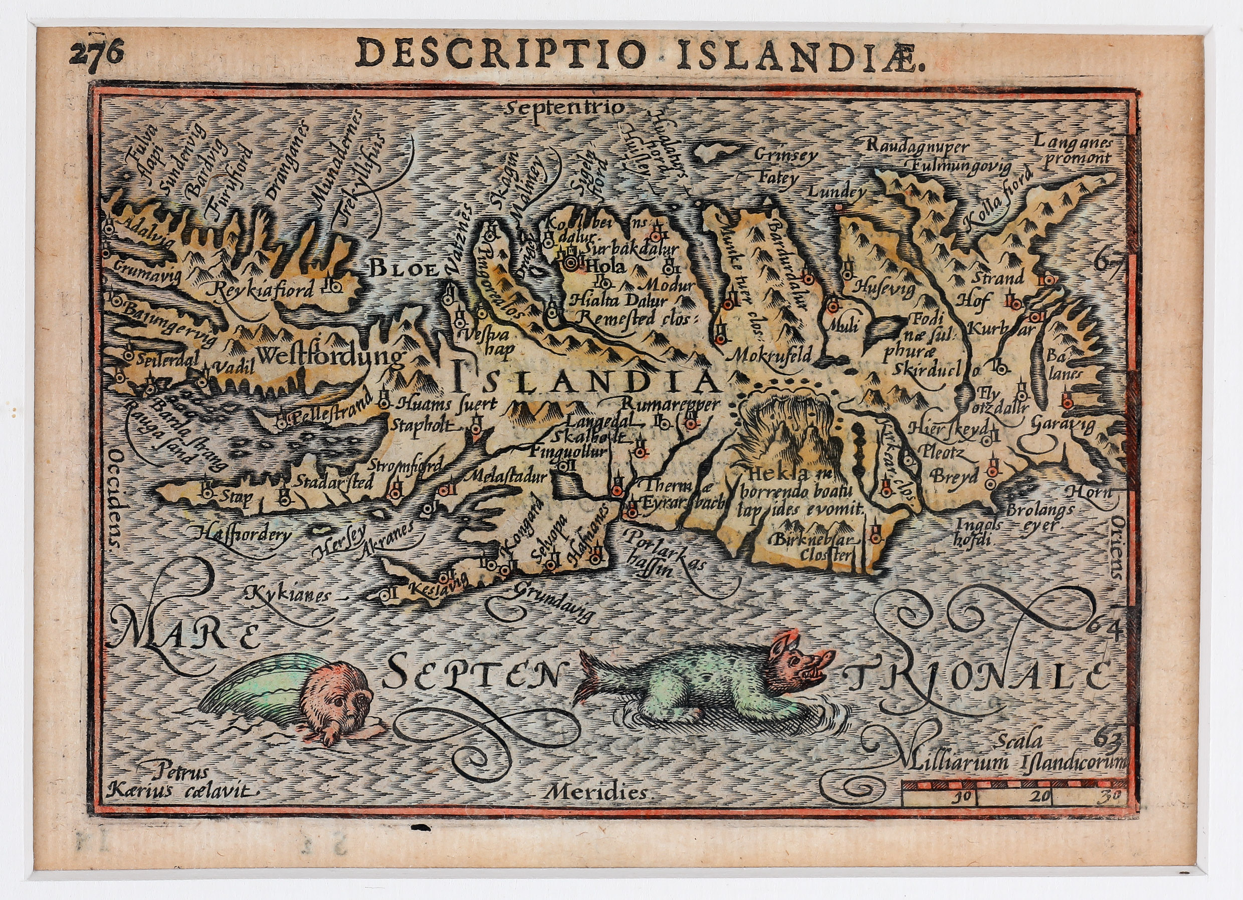
This rare miniature map of Iceland from 1598 is based on Abraham Ortelius’ classic map of 1590. It is titled Descriptio Islandiae, with Islandia written in the centre.
Despite its small size, the map contains nearly 80 place-names, many marked with church symbols, including the bishoprics of Skálholt and Hólar. Hekla is shown erupting, with a Latin inscription describing the volcano as throwing out stones with a terrible roar.
The surrounding sea is hatched and decorated with two sea monsters. No glaciers are shown or named. The map was engraved by Petrus Kaerius, as noted in the inscription in the lower left corner.
no. 112.
Re Di Svetia
1598
Abraham Ortelius (1527 – 1598) & Pietro Maria Marchetti (unknown)
Abraham Ortelius (1527–1598) was one of the most influential mapmakers of the 16th century. His Theatrum Orbis Terrarum, first published in 1570, is often regarded as the first modern atlas: a systematic collection of uniformly sized maps based on contemporary geographical knowledge.
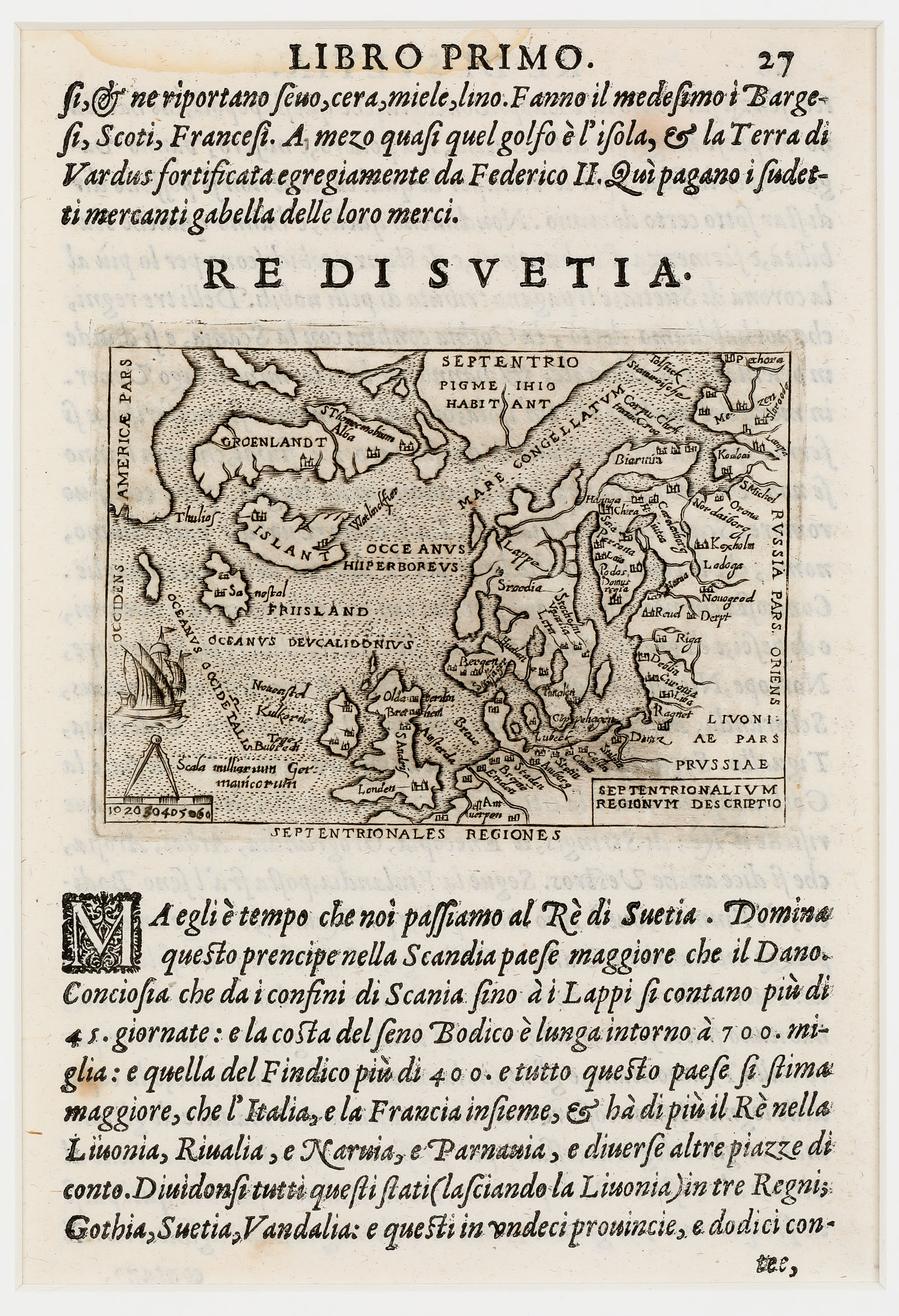
This sheet comes from Pietro Maria Marchetti’s rare Italian Theatro of 1598, a reduced version of Ortelius’ atlas. The miniature map shows the North Atlantic, including Iceland, Greenland, Scandinavia and the mythical island of Friisland. Iceland is named Islant, with two unnamed church symbols probably representing the bishoprics of Skálholt and Hólar.
The map also includes imaginary or misunderstood northern geography, including a large land named Septentrionales and the curious inscription Pigme Ihio Habitant — “Pygmies live here”. It reflects the mixture of knowledge, legend and error that shaped European views of the far North.
no. 151
Septentrionalium Regionum Descriptio
1598
Abraham Ortelius (1527 – 1598)
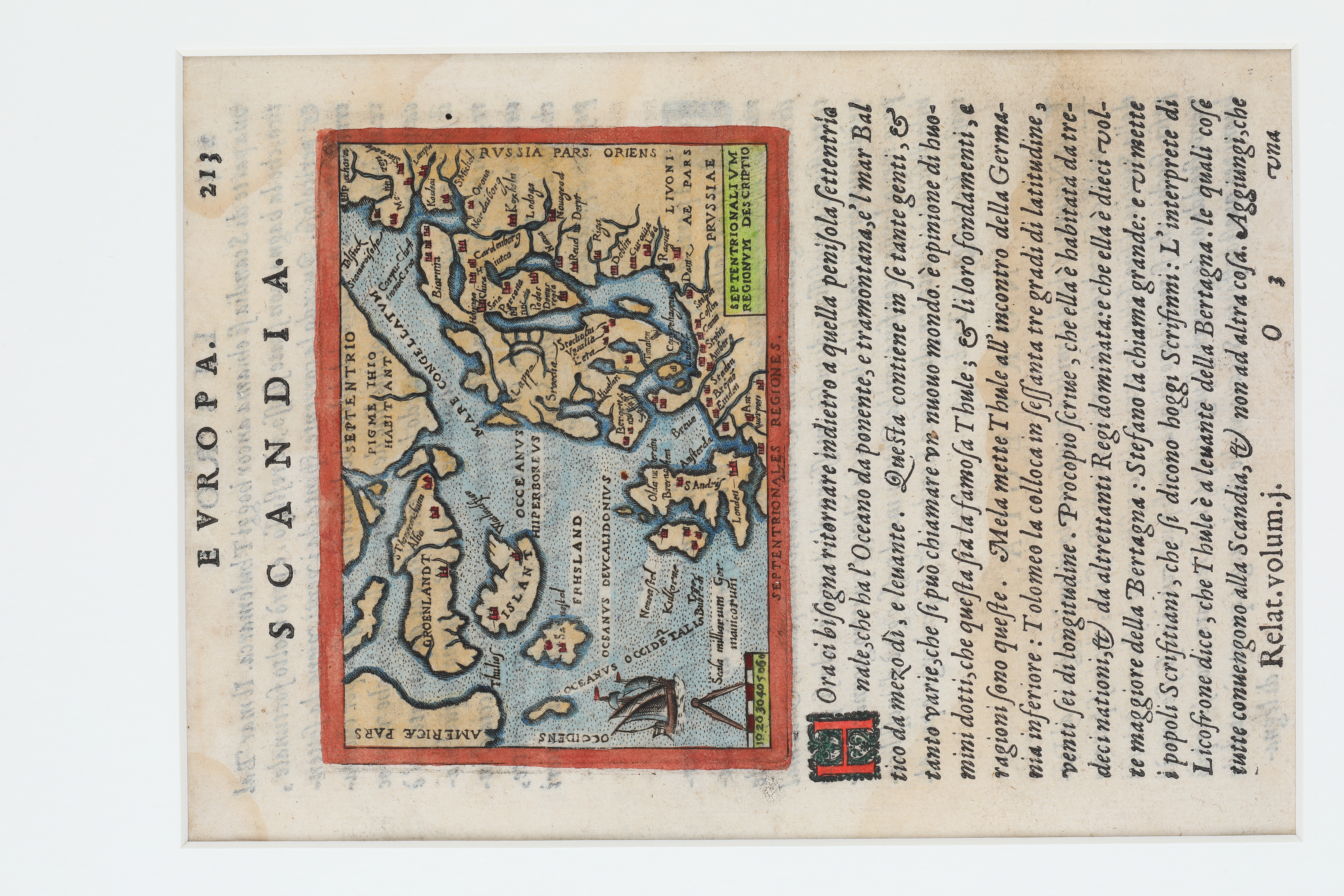
This miniature map comes from Ortelius’ Epitome Theatri Orteliani, a pocket version of his famous atlas Theatrum Orbis Terrarum, first published in Antwerp in 1585. This example, from around 1598, is surrounded by Italian text.
The map shows the North Atlantic from part of America in the west to Russia in the east, including Iceland, Greenland, Scandinavia, the British Isles and the Baltic region. It also includes imaginary geography, such as the mythical island of Frisland and a large northern land named Septentrio, accompanied by the curious inscription “Pygmies live here”.
Iceland is named Islant and marked only by two unnamed church symbols, probably representing Skálholt and Hólar. The map reflects the reduced format of the Epitome, where geographical information was simplified but older legends and misconceptions of the far North remained.
no. 202
Schonladia Nuova
1598
Girolamo Ruscelli (1504 – 1566)
Picture will be here soon
This scarce map from Ruscelli’s Geography of 1598 is a revised version of his earlier map of Scandinavia. It shows Scandinavia, the Baltic region, western Russia, northern Germany, the British Isles, Iceland and Greenland, with the frozen northern sea marked as Mare Congelatum.
Iceland is shown as the large distorted island Thyle, north of Scotland. The name refers to the legendary island of Thule. Only two Icelandic place-names appear: Skalholten and Holensis, representing the bishoprics of Skálholt and Hólar, but without church symbols.
The map contains several updates from earlier versions, including more place-names, added mountains, coastal hatching and a sea monster west of Iceland. Although Ruscelli corrected some errors from Gastaldi’s earlier map, the name Islandia is missing entirely.
no. 62
Islandia
1600
Matthias Quad (1567 – 1613)
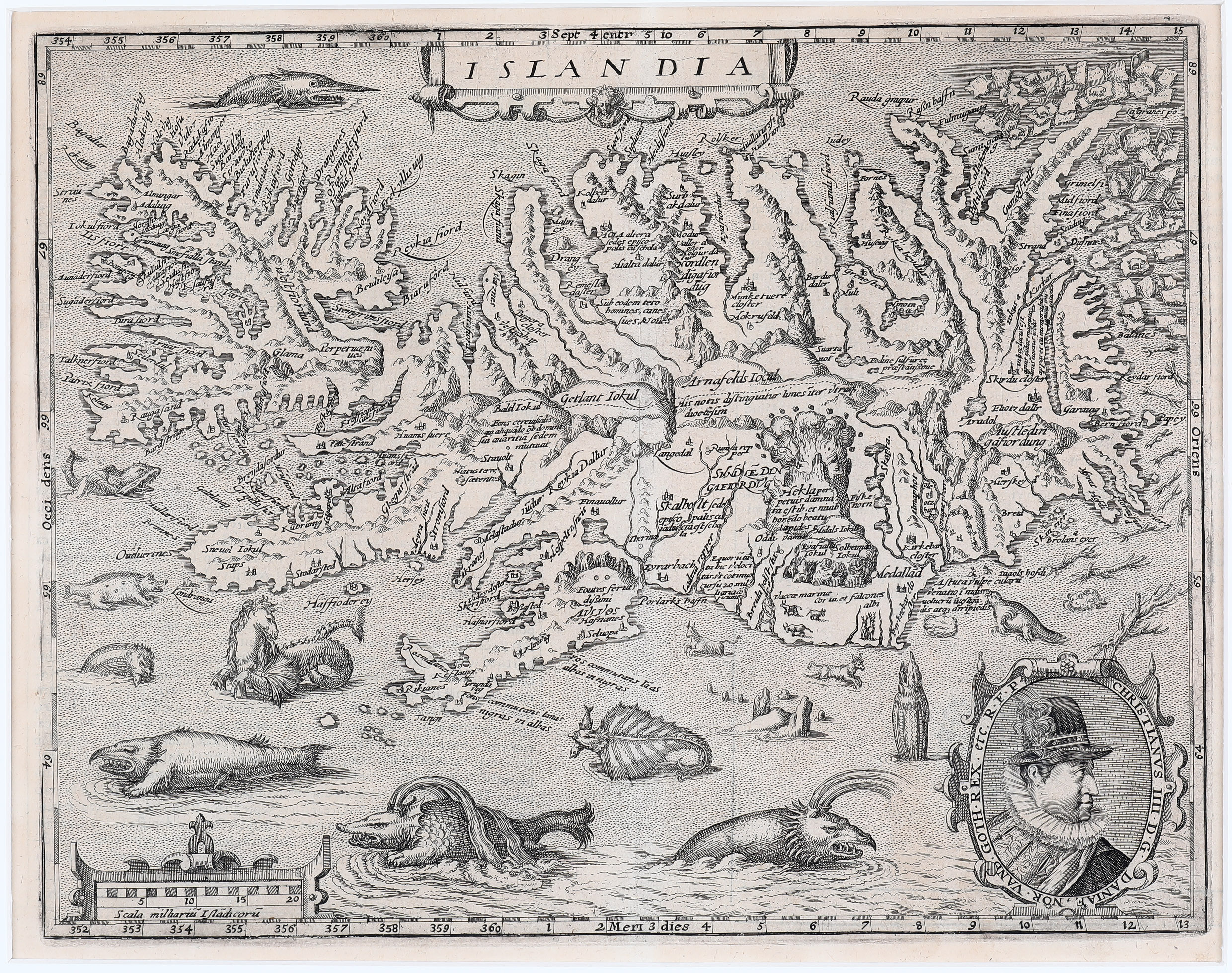
This decorative map appeared in the Geographisch Handtbuch in 1600. It is a reduced copy of Abraham Ortelius’ famous map of Iceland from 1585.
Iceland is shown in considerable detail, with mountains, fjords, glaciers and more than 200 place-names, including the bishoprics of Skálholt and Hólar. Hekla is shown erupting, accompanied by a dramatic Latin description of the volcano throwing out stones with a terrible roar.
The surrounding sea is filled with sea monsters, whales, walruses and other creatures, while polar bears float on icebergs off the northeast coast. A portrait of Christian IV, King of Denmark and Norway, appears in the lower right corner.
no. 3
Islandia
1572
Abraham Ortelius (1527 – 1598)
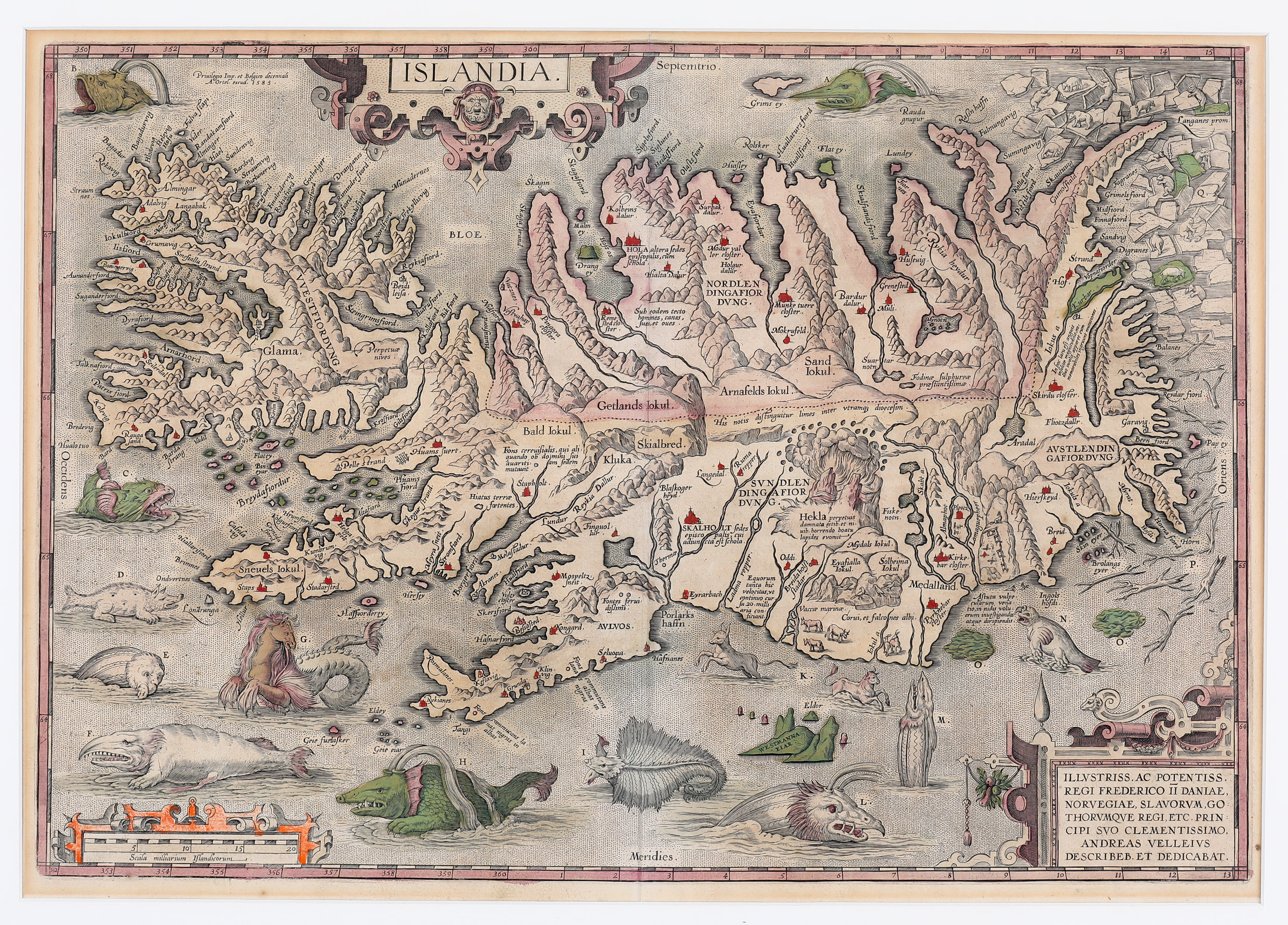
Was this map made by the Flemish-Dutch cartographer Abraham Ortelius, often regarded as the godfather of the Dutch Golden Age of cartography?
In the lower right corner, the map is dedicated to Frederick II, King of Denmark and Iceland, and to the Danish historian Andreas Velleius, who probably supplied the map to Ortelius. However, much suggests that an Icelander was involved in its creation, most likely Guðbrandur Þorláksson, Bishop of Hólar and scholar (1541–1627).
Several details support this theory. The outline of Iceland is relatively accurate, despite some distortion, and the number of place-names and their precise locations point to local knowledge. This is especially true of the highlands, where information appears that is not found on earlier or later maps.
“The map was rather expensive for a newly married couple, but we had to have it and arranged with the seller to pay for it in six instalments.”